SITE: Geophysical
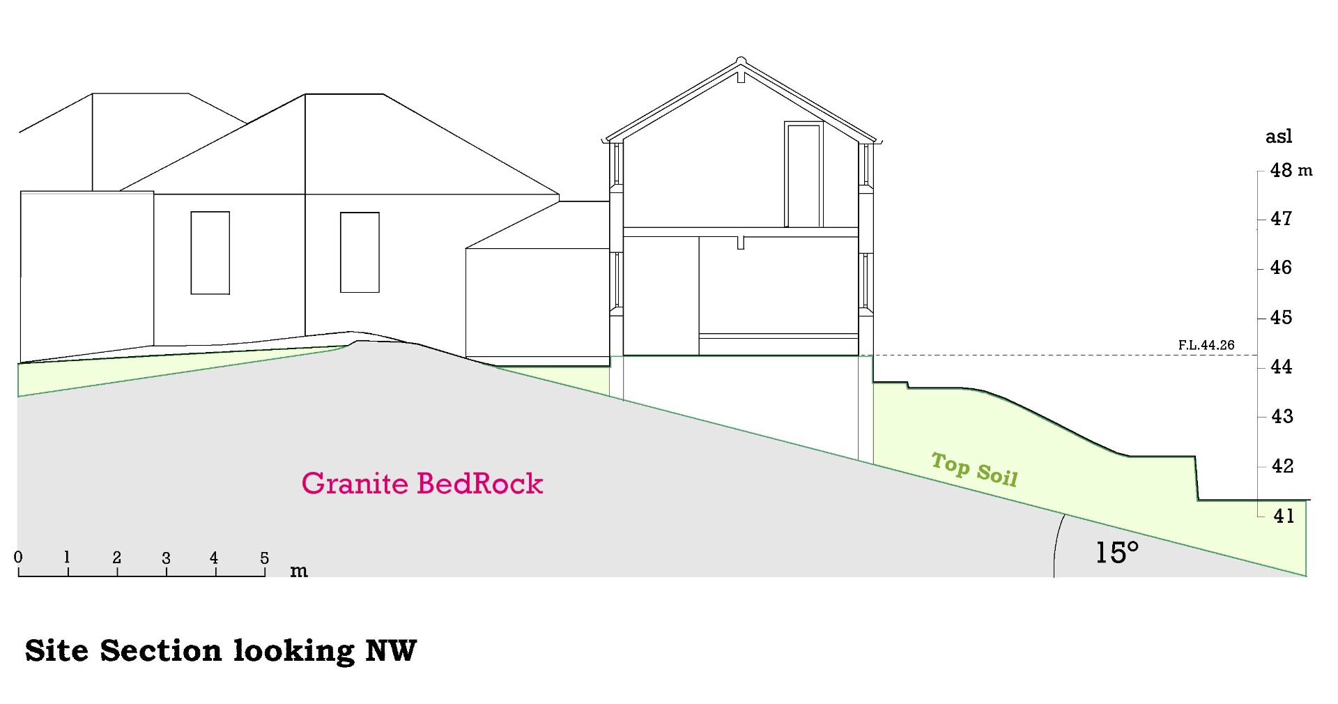
The majority of the investigation was carried out at Barnbarroch Pottery, near Dalbeattie in the Dumfries & Galloway region of SW Scotland. The site consisted of a horse-shoe shaped cluster of buildings comprising of a single storey Victorian former school with thick granite walls, linked by a glazed conservatory to a 1980's 2-storey house constructed of dense block - the whole group wrapped around the peak of a granite outcrop (h. 44.74 m a.s.l.) which sloped away steeply towards the NE (≥15°) beneath the house. The total garden area amounted to about 1,600 m2 with a fairly level area of topsoil along the Northern boundary at the lowest point on the site (h. 41.0 m a.s.l.). See aerial photo, elevation, and section below.
The site lay on the Northern shore of the Solway Firth (OS Map reference NX 843 564: Latitude 54°53′20″ N, Longitude 3°48′18″ W) less than a kilometre from the estuary of the river Urr, on a NE facing lower slope of a small valley (see maps below). The ground inclined 625 m towards the SE with an average gradient of 6° to the top of Doon Hill (h. 110 m); and inclined 400 m towards the SW with an average gradient of 4° to the top of Gibb's Hill (h. 73m) - see contour maps below. The geology of the immediate hinterland consisted principally of extremely dense 'Dalbeattie' Granite with many exposed outcrops, such as Craigie Knowes (shown in the first two photos below) and the Slab (last photo below).
The BGS observed gravitational field strength at the point closest to the Barnbarroch site was given as 981494.22 mGal at elevation 41.1 m; (free air anomaly 9.8 mGal; Bouguer Gravity Anomaly 5.4 mGal; and density for Bouguer corrections 2.7 g/cm3) [based on observations made by Durham University at 1 per 2 km2]. See accompanying figure below.
The Geomagnetic Field for the site was checked in 2018 on the BGS website [1]: Magnetic Declination was given as negative (west) 2° 7′; and Magnetic Inclination as 68° 59′, with a total field strength of 49649.3 nT (see fig. 1.4.2). In this same year, individual points on the site were assessed for possible local magnetic variations using a Dip Circle and a standard mapping compass (cross-referenced with a GPS compass set to True North). The equipment was mounted on a 75 cm high wooden stand, and placed at a minimum distance of 0.75 m from walls and other potential sources of magnetic influence while the stand itself was checked to ensure any magnetised nails or screws were at sufficient distance to not affect the instrument.
[1] https://www.geomag.bgs.ac.uk/data_service/models_compass/wmm_calc.html


